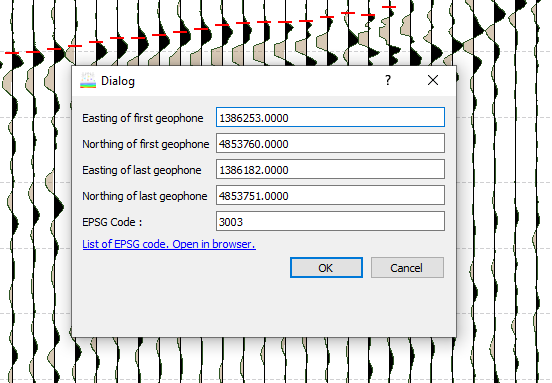
SmartTomo allows to geo-reference the profiles of seismic refraction tomography in order to visualize them with external tools overlaying for example the DTM.
Continue reading “Geo-referencing a seismic tomographic profile.”
smartTomo – imaging the subsurface of the Earth
Software for processing seismic tomography
SmartTomo allows to geo-reference the profiles of seismic refraction tomography in order to visualize them with external tools overlaying for example the DTM.
Continue reading “Geo-referencing a seismic tomographic profile.”This guide introduces the fundamental steps to process seismic refraction tomography with smartTomo software. The demo version is distributed with a pre-loaded dataset. The characteristics of the dataset are described in this article (Demo version).
At startup the following screen appears reminding you that this is a demo version and it shows the list of files that will be loaded.