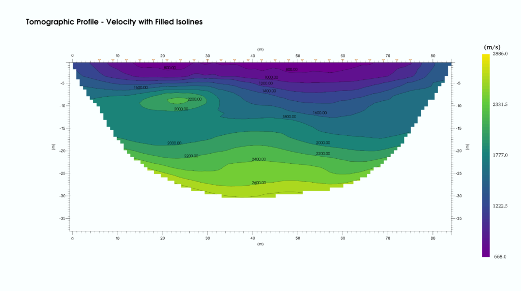
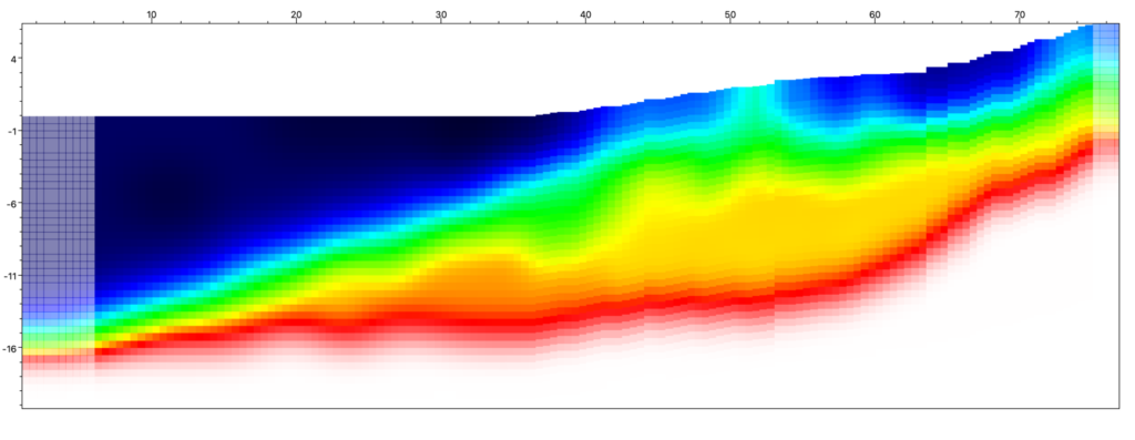
A seismic survey was carried out to investigate the quality of the rocks under a secondary road with damage. The space for the seismic line was limited by the morphology of the slope.

smartTomo – imaging the subsurface of the Earth
Software for seismic tomography
A seismic survey was carried out to investigate the quality of the rocks under a secondary road with damage. The space for the seismic line was limited by the morphology of the slope.
In this work, seismic refraction tomography (SRT) was performed to investigate the characteristics of the subsoil and to investigate the evidence of the presence of a tunnel used for the carrying of water.
The survey was carried out using 24 vertical geophones and performing a high number of vertical energizations both inside and outside the line, in order to have a good coverage by seismic rays throughout the section.
Continue reading “Case study – Detection of a tunnel.”Following the rupture of an water pipeline, a landslide movement occurred in an area classified as highly susceptible to collapse. The event dislocated a retaining wall and created tension cracks in the ground. In order to define the geometry of the materials involved in the movement, a seismic survey was carried out using the technique of seismic refraction tomography and the MASW.
Continue reading “Case study: Evaluation of the depth of the rupture surface of a landslide”