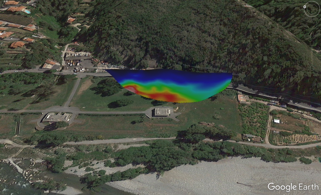
SmartTomo allows to geo-reference the profiles of seismic refraction tomography in order to visualize them with external tools overlaying for example the DTM.
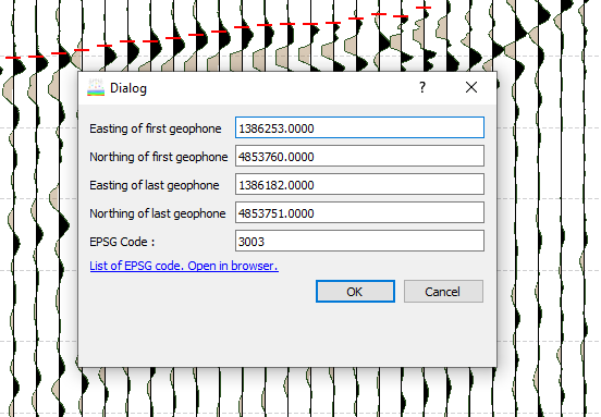
To georeference the profile is necessary to enter the coordinates of the first and the last geophone expressed in a metric projected coordinates system and the EPSG code that identifies the reference system used for example UTM zone 32N epsg 32632.
SmartTomo places the first geophone at the indicated coordinates and uses the coordinates of the last geophone to calculate the direction in which the line is oriented. The coordinates of all other elements are calculated using rigidly, without deforming it, the geometry defined in the project.
The geo-referenced profiles can be exported in a textual table that can be imported in graphic software such as Surfer or in KML format to be visualized in Google Earth.
The textual table has 4 columns matching the values of Northing (m), Easting (m), Elevation(m), Velocity (m/s):
1500986.875000 4900000.000000 -0.375000 651.899775
1500987.625000 4900000.000000 -0.375000 647.997202
1500988.375000 4900000.000000 -0.375000 643.732885
...